


Laser show at Rödeserberg
Nikola Vasiljević, Ph.D.
Test and Measurements section
DTU Wind Energy
Contact: [email protected]
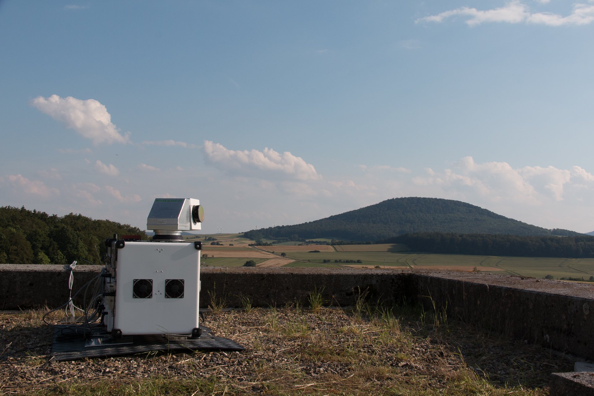
During the period between the end of June and mid August 2014 a unique measurement campaign with a multi lidar system, which consisted of six long-range WindScanners coordinated by the master computer, took place at Rödeserberg in vicinity of Kassel, Germany (Figure 1). This measurement campaign was performed as a part of the WindScanner.EU project, and it is a result of collaborative efforts of DTU Wind Energy, Fraunhofer-IWES and ForWind.
The three main objectives of the campaign were to:
- Apply scanning lidar installation procedures
- Demonstrate the synchronization of multiple lidars over a mobile network
- Validate the system’s wind velocity measurements against the mast in forested complex terrain.
The campaign was successful. The laser beam pointing accuracy of about 0.05˚ was achieved by applying rigorous installation procedures. This means that the laser beam position was able to be determined within 1 m at 1 km distance. Despite a few occasional network issues all six WindScanners were synchronized, and the maximum lag between the WindScanners was kept below 10 milliseconds during the entire campaign. The comparison of the long-range WindScanner system and the mast mounted sonic anemometers measurements showed that the system is able to measure the wind velocity within 1% uncertainty even at ranges of several kilometers in forested complex terrain.
The results of the campaign at Rödeserberg imply that the measurement system based on multiple long-range WindScanners can potential become a valuable tool for atmospheric and wind energy research.
See the video from the pilot synchronization test:
https://www.youtube.com/watch?v=0QfaLj6trkw&;feature=youtu.be
See the photo gallery from the campaign:
http://work.courtney.dk/#!album-288
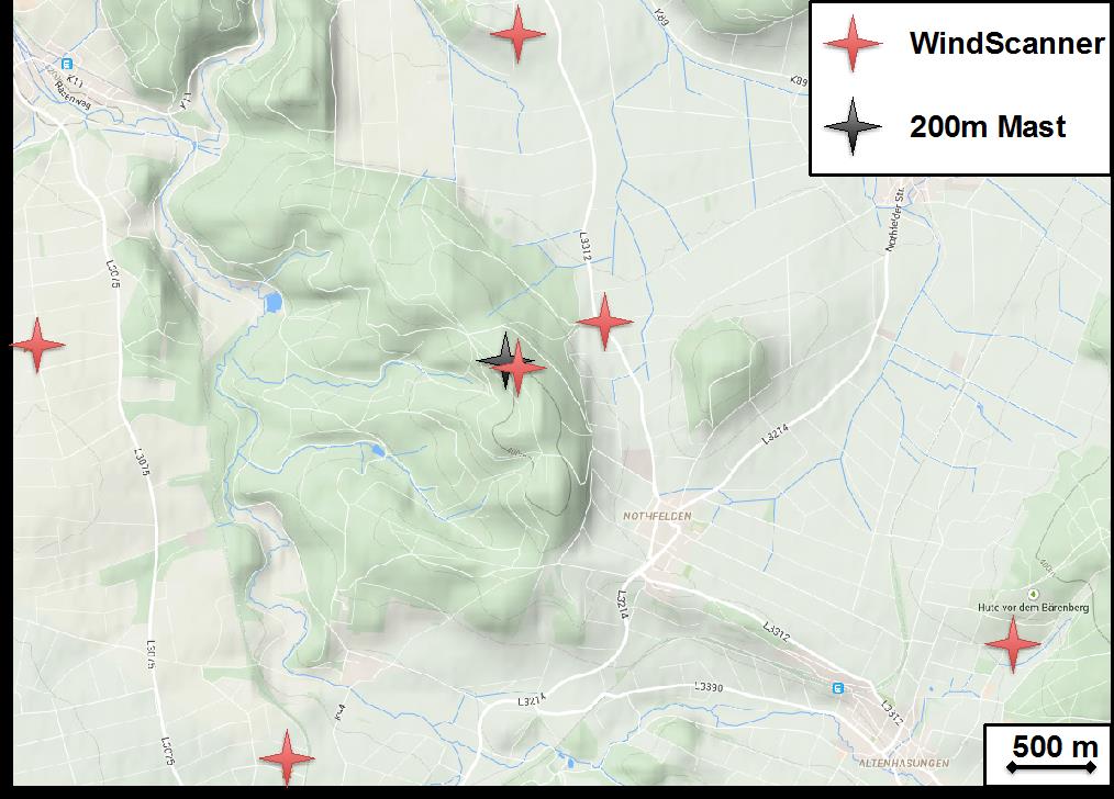
Figure 1: Positions of WindScanners and met mast
Further information on the long-range WindScanner system:
Nikola Vasiljevic. A time-space synchronization of coherent Doppler scanning lidars for 3D measurements of wind fields. PhD thesis, DTU Wind Energy PhD-0027, March 2014
Nikola Vasiljevic, Guillaume Lea, Michael Courtney, Jakob Mann, and Torben Mikkelsen. The long-range WindScanner system – how to synchronously intersect multiple laser beams. In EWEA 2013, February 2013
Nikola Vasiljevic, Guillaume Lea, Michael Courtney, Jörge Schneemann, Davide Trabucchi, Juan-José Trujillo, Robert Unguran, and Juan-Pablo Villa. The application layer protocol: Remote Sensing Communication Protocol (RSComPro). DTU Wind Energy E 0017 (EN). DTU Wind Energy, 2013.
 BACK
BACK
